Announcement:
BGS acquires Forsite Consultants, Northwest Management, Inc.
Read the Press Release Here
Our Forestry Solutions
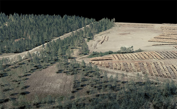
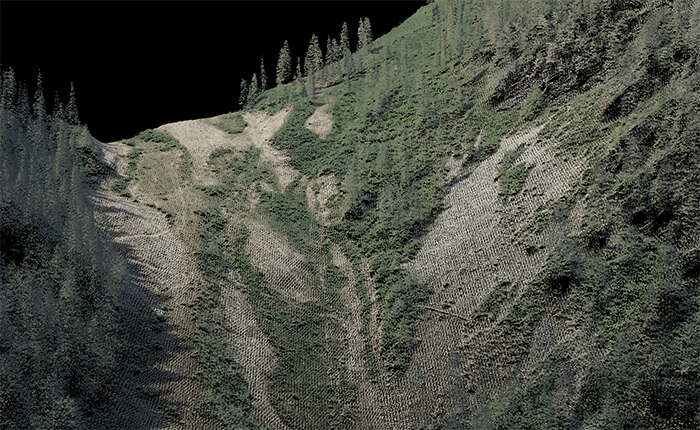
Unlock the full potential of your forestry management with Barr Geospatial Solutions (BGS). Barr Geospatial Solutions (BGS) has collected LiDAR and Imagery of hundreds of millions of acres of forestry lands throughout North America in the last decade. Utilizing the latest in LiDAR sensor technology and large format multi-spectral cameras, BGS has enabled cost-effective expansion of forestry mapping for metrics, individual tree analysis, and planning on both private and federal lands
Imagine having the power to view and map individual tree shapes and species with unparalleled detail. Our high-density LiDAR collection creates detailed terrain models, while our 4-band imagery offers insights into forest health. With these advanced tools, you can plan, design, monitor, and cultivate your forests with unmatched precision and efficiency, all from the comfort of your desktop. This innovative approach not only reduces the need for costly field surveys but also enhances project safety by minimizing on-the-ground risks.
Why Choose BGS?
- Innovation and Expertise: Our team of LiDAR and forestry experts are at the forefront of the industry, combining deep scientific knowledge with practical experience to deliver exceptional results.
- Advanced Technology: We utilize the latest in LiDAR and multi-spectral imaging technology, ensuring you receive the most accurate and detailed data available.
- Cost-Effective Solutions: Our methods are designed to maximize efficiency and reduce costs, offering you more value without compromising on quality.
- Comprehensive Services: From forest inventories to wildfire risk management, our suite of services covers all aspects of forestry management.
Ready to Transform Your Forestry Management?
Discover how our innovative approaches and solutions can elevate your forestry operations. Contact us today to learn more about our advanced capabilities and how our team of experts can help you achieve your goals. Let BGS be your trusted partner in forestry management, bringing you the future of forestry today.
Our Capabilities Include:
- Data-Driven Forest Inventories: Utilizing advanced vegetation management and machine learning for efficient forest inventories and tree species classification.
- Advanced Vegetation Management for Utility Corridor Risk Assessment: Combining LiDAR, spectral data, and machine learning to identify individual tree locations and attributes such as species, height, diameter, and health.
- Individual Tree Inventories: Leveraging LiDAR data to segment and attribute individual trees, facilitating detailed analysis and planning.
- Fire Spread Modeling and Risk Assessment: Advanced modeling techniques for assessing wildfire risks and developing risk reduction strategies.
- Risk Reduction Treatments and Strategies: Implementing strategic treatments and strategies to minimize wildfire risks.
- LiDAR-Assisted Digital Inventory®: Integrating highly accurate field data with advanced technology to increase the ability to "see" and quantify diverse natural resource conditions. Our ForestView® suite combines aerial LiDAR, aerial imagery, satellite imagery, and precision field data to offer detailed measurements of forestlands, woodlands, rangelands, streams, and forest accessibility networks at less cost and with greater accuracy.
- User-Friendly Dashboards: Providing intuitive dashboards for easy access to detailed forest data and analysis.


