HCA & Class Location
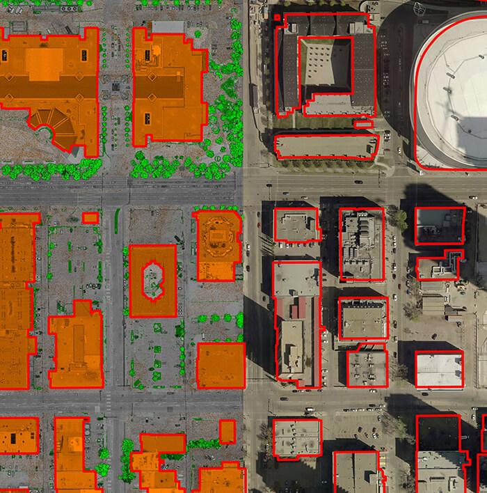
Barr GeoSpatial has a comprehensive class location, HCA and MCA program. Barr collects high resolution imagery coupled with oblique imagery from our Talon360 patrol cameras and LiDAR data to identify structure change and identify the type of structure along the right of way.
Databases are then cross referenced to better determine use case and population density. Our multi-faceted approach not only allows for accurate structure counts but faster identification of the type of structure and number of people living in those structures.
Using geospatial data for class location saves operators time and money as field crews are not needed for identifying new structures and type of structure. Field crews can be sent to the select locations where data has identified change but imagery and public data records don’t allow for identifying the type of structure or population density.

